Ukraine Launches Missile Attack on Sevastopol

On September 22, Ukraine launched a missile attack on the Headquarters of the Russian Black Sea Fleet located in Sevastopol, Crimea. WNM collected and analyzed the most recent materials on the strike.
Journalist Johnny Miller based in Sevastopol happened to film the moment of strike. He is said to be working for Russia, and it explains why the journalist is extremely careful what to show in this video. Several explosions, however, can be heard.
Geolocation
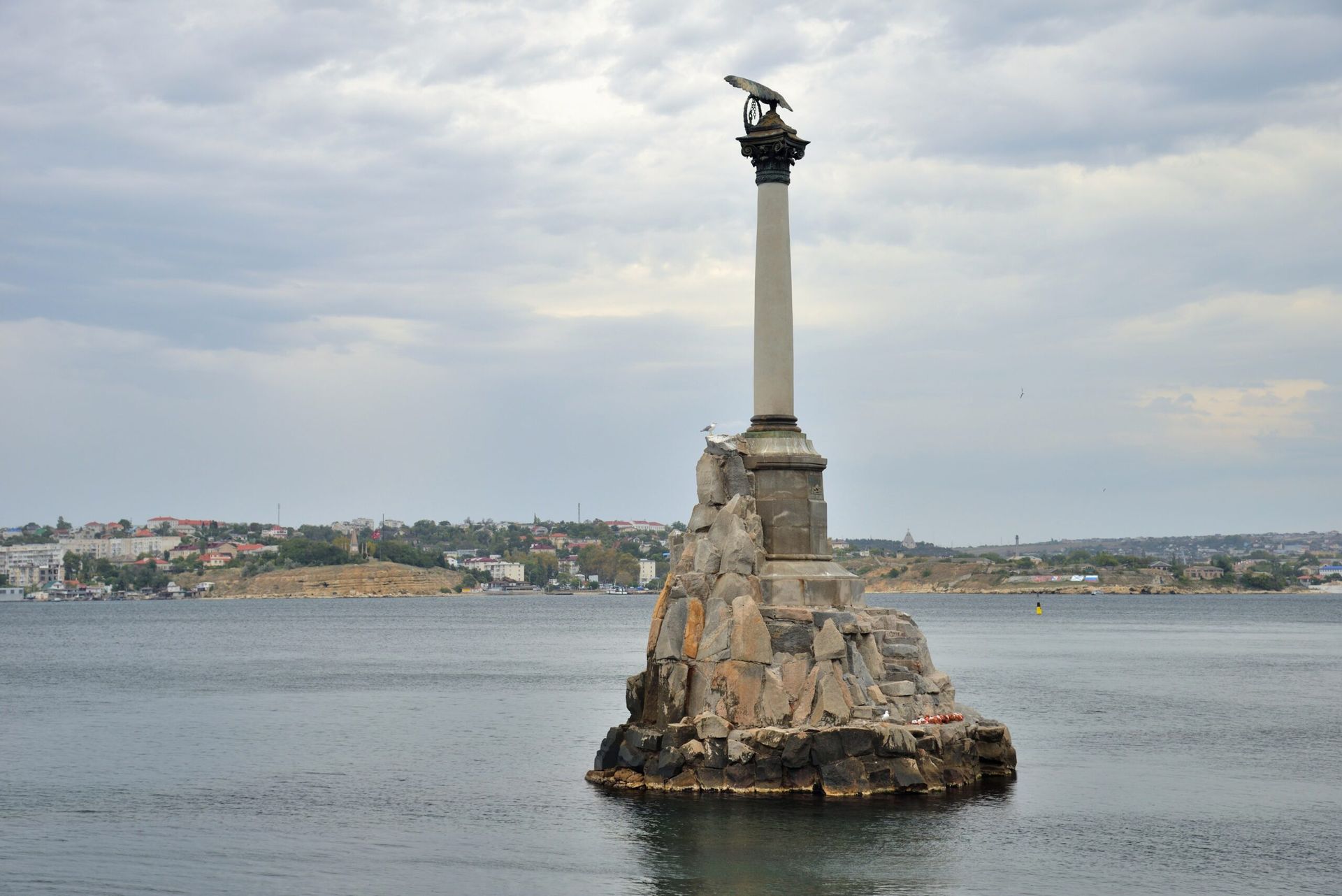
The Monument to the Sunken Ships is clearly visible on the background, that makes it easy to geolocate the video. The coordinates are: 44°37’5.79″N, 33°31’29.61″E
Video metadata:
The metadata shows that the video was taken at 10:30 am, however the author is a British journalist who might use the BST (British Summer Time) on the camera. Considering this, 10:30 am matches the 12:30 pm Sevastopol time. This hypothesis is confirmed by other mentions of the explosions around the same time.
At 6:12 am EST or 1:12 pm local time the users started discussing the explosions heard in one of the Sevastopol Telegram channel.
Message at 6:12 am EST asking: “What are these explosions?”. Users reply with “air-defense” and “exercises are taking place”.
Sevastopol’s governor posted at 6:20 am EST, 1:20 pm Sevastopol time a text saying: “The enemies launched a missile attack on the fleet headquarters.
A fragment fell near the Lunacharsky Theater. If you find such elements, we kindly ask you not to approach and call 112.
All emergency services arrived at the scene. Information about the victims is being clarified.
Please remain calm.
And do not post photos and videos.”
Thus, the missile strike possibly occurred around 1pm local time.
Yandex Maps, Russian service, shows the road closure around the fleet headquarters. Yandex shows that the roads were closed around 3 pm local time.
The most recent closure – 3:22 pm local time.
The video below shows the police blocking the way to the headquarters.
The video was taken at 44°36’39.72″N, 33°31’15.06″E that matches the point of a closure on the Yandex map.
Below is the geolocation of all the significant for this scene objects:
Later, around 12 pm EST, 7 pm local time, Russian Information Agency TASS published a video of the destroyed Black Sea building. The building is missing several floors.
Another picture showing the building after missile strike was shared in the commentary section of one of the local Vkontakte groups (Vkontakte is the largest Russian social network). The note says: “Crimea is Ukraine” in Ukrainian language. The Black Sea Fleet Headquarters is visible on the background.
Russian Reaction
Several Russian sources reacted to the strike indicating the presence of NATO aircraft. Vkontakte group “Zhest Crimea” posted a screenshot of FORTE11 aircraft route around Black Sea. FORTE11 is a United Stated Air Force unmanned aircraft, used for surveillance.
And American Poseidon Aircraft. This aircraft is providing maritime patrol and reconnaissance. This post is shared by RT Telegram Channel. RT is a Russian state-owned news channel. Moreover, RT is using the aircraft presence as a prove that Ukrainian President Zelensky’s visit to the US and Canada might be connected.
More from the author


